From the Editor Here we are...
 (2000 × 75 px) (2000 x 60 px)")
From the Editor Here we are...
The NSW Government is rethinking its water...

Residents and ratepayers have slammed the Hawkesbury City...

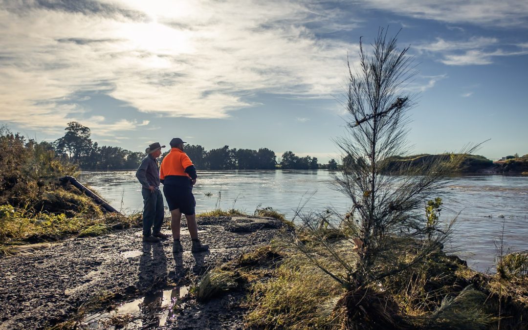
It wasn’t a case of if, but when.
The 2021 flood emergency was a while coming but when did it was a full bore flood, the like of which the Hawkesbury hasn’t seen for decades.
It shouldn’t have surprised anyone. Fact is, we live on a flood plain and the Hawkesbury has flooded before, often with large loss of life.
So emergency systems were in place, everything was ready, and Council had a new emergency dashboard which brought all emergency information together. The big question is – did the emergency response work smoothly?
And it’s an important question because of course it will happen again.
Council’s emergency dashboard – officially called the Disaster and Emergency Dashboard – is a fine idea. It was launched last year with much fanfare and was welcomed simply because it pulled together information from all emergency services, plus an all-important section on road closures, into one place. Somewhat surprisingly, it’s the first time that has happened.
But when it was asked to perform in the white heat of battle, if you like, it floundered, especially when it came to road closure information.
Mayor Patrick Conolly told us, “I have received a lot of positive feedback from the community about the Dashboard, along with suggestions to have other information included in the future.”
We put it to Council’s Corporate Communications Manager, Suzanne Stuart, that the dashboard didn’t perform well at all when the flood hit hard and roads were suddenly submerged or cut off.
“It absolutely did work, yes,” Ms Stuart said.
“As the Council Disaster and Emergency page missed critical stages of the flood event unfolding I gave up on it as a source of localised information on roads and ferry services,” said Stephen Brown from St Albans, a past President of the Macdonald Valley Association.
“The lag of many days meant it was not an information source that could be relied on.
“It’s unfortunate to say this, as I’ve been an advocate of it and promoted it widely. Saying this, any system is only as good as the infrastructure behind it and in terms of Council, resources and systems, they do not appear to have an executable emergency plan under the auspices of NSW State Emergency Management Plan (EMPLAN).”

Could have done better….Council’s online emergency dashboard…
The issue with the emergency information on Council’s dashboard is two-fold.
Some areas of the Hawkesbury are not mentioned or covered at all – the Macdonald Valley is the clearest example – so during the flood event when the area was devastated there was no SES reporting for residents, so no evacuation warnings getting through, and nothing reliable on road and ferry operations. They were basically on their own in the Valley – one of the hardest hit areas when it comes to floods.
The second issue is the unreliability of the Council’s closed roads information. Many roads which were said on the site to be closed had in fact been reopened as flood waters started to recede, so it was impossible to tell which information was current, and which roads were open or closed.
That inaccurate information continues to this day.
Today – Wednesday – to pick just one example, it says there is a hazard at Grose Vale Road, Grose Vale and you should pick an alternative route – the road is closed. It’s reported this since April 7. The dashboard also doesn’t specify where issues are on a particular road, so if you’re talking about Grose Vale Road you have no idea exactly where the hazard is. Now, local knowledge tells this writer that a section of the road was closed for some time after heavy rain caused landslips and fallen trees. The road was cleared and completely reopened a week ago, yet it is still listed as hazard, use alternative route.
The same thing happened as the floods were receding, with normally busy Windsor Road between the Jolly Frog and The Australian public house, still marked as closed after thousands of motorists were back on the reopened road. The LiveTraffic app wasn’t much better either – 20 minutes after the road was being used by motorists, the app still had it down as closed. The same thing happened with Comleroy Rd, Kurrajong where flooding was still reported on the dashboard after we’d driven down the opened flood-free road two days earlier.

St Albans…cut off physically, and cut off from information too…
There’s only one thing worse than no information – and that’s incorrect information, especially when you’re in the middle of a big disaster.
But Council’s Jackie Carr, the Executive Manager Operations, told us the dashboard has been “a very useful tool for the community for road updates and we encourage everyone to become familiar with using it. When planning your route on smaller local roads, first check the updates on local roads on Council’s Hawkesbury Disaster and Emergency Dashboard https://disaster.hawkesbury.nsw.gov.au as any road closures and ferry services are placed on the Dashboard”.
As the flood emergency began to gain momentum, one Macdonald Valley resident got on Council’s Facebook page and asked how locals could get flooded road info up on the dashboard. He was told in a reply from Council on the social media site that he should report it and then council staff would drive out there and verify it and it would then be added to the dashboard.
As the flood emergency rapidly escalated it is hard to see how – and why – a council employee would be tasked with such a potentially dangerous drive, but there’s no evidence – no information on Macdonald Valley conditions appeared on the dashboard – that this happened anyway.

Grose Vale Road, still marked as a hazard, but cleared and open for a week now
Council’s Ms Stuart believes only information from official sources – and council employees – was worth paying any attention to.
“Your mate up at Colo,” is not a good source of information,” Ms Stuart told us. “The information on the dashboard is.”
Funnily enough, as the emergency unfolded, the information Hawkesbury Post received from hundreds of “your mate up at Colo” – the residents of the Hawkesbury who supplied us with pictures and stories and information which gave us and our readers a real time picture of what was happening across the Hawkesbury – was very accurate. Coupled with information from our political and ministerial connections, and our emergency service connections, it built a panoramic picture of what was happening out there.
As the situation continued to evolve, Mayor Patrick Conolly became – along with Council’s website – the main fount of knowledge about what was happening. Thanks to the Mayor’s daily videos – each around a minute and a half long – you could tune in on Facebook (if you use FB, of course) and find out a little of what was happening.
Trouble was, we were never alerted by Council’s media staff to the existence of the Mayor’s daily video, so we missed several.
It’s very unusual during any emergency not to keep media well informed – after all, we can get messages out there quickly. But Council is moving, as Ms Stuart puts it, “to becoming our own newsroom”, so perhaps it’s not surprising.
Trouble is, councils aren’t news operations – and there’s more to news then simply a stack of information, and if you have time to look at the new Draft Communication and Engagement Strategy currently being discussed in Council, in part it says, “we work with the media to deliver our messages.”
We didn’t receive any daily media updates, or any backgrounding from Council’s media team, which admittedly is only two people. But given everyone knew this emergency could happen one day – and we’ve been through a major fire emergency too recently – you could be forgiven for thinking perhaps some contingency plan would have been put in place to increase resources.
The problem is, Council sees media as something peripheral, rather than as an integral tool in an emergency event.
“All of our information, whether it be a Facebook message or a media release goes onto the Flood Recovery 2021 website so keeping an eye on the website and sharing that link to that site is the best information to share with the community,” was the advice given to us by Ms Stuart, who added, “this Council website is our source of truth.”
Mayor Patrick Conolly is proud of his video initiative, and with good reason, because he reckons, “ the videos reached tens of thousands of people, and I have had people thank me for providing the videos as a quick and innovative way to stay up to date”.
Cllr Conolly says all of his video information was also on Council’s website.
We asked why the Mayor’s daily videos – now moved to what looks like a weekly short video – didn’t contain closed captions for the hard-of-hearing, or sign language.
These simple features are imperative in any presentation by officials to the public, and particularly in a time of emergency – it’s hard to think of another government organisation that doesn’t do this.
Ms Stuart told us some people had mentioned this and it would be taken on board.
And what of the people out there hit by the floods? How did they perceive the support they were offered?
Mel Schenk lives on a five-acre farm at Freemans Reach. Ms Schenk is a barrister and we talked to her a couple of days after flood waters had crashed through her property on Freemans Reach Road, ripping fences away, knocking big conifers down and wrecking much of the ground floor of her house. When we spoke to her, Ms Schenk’s ruined kitchen was in the driveway.
She said she was furious at the lack of help from council and government.

Freemans Reach Road – plenty of work still to do, but should be reopened within a month
She also said a lot of her land had also subsided into the river.
“We got in contact with SES and they said it’s not us. There has been a deafening silence about who handles that [subsiding river banks]. There are a lot of implications, not just for us, but for the river at large. There is no one to ring.
“No one has been down here. I tried to engage [council] by SMS and email, I said are you still going to be doing our garbage service and it was, ‘put them out and see and we’ll try and get to it’. Seriously that is the extent of the assistance given to me. I didn’t know this – someone told me – but you could book a kerbside pick-up once a year for 1.5cu m, and it’s pissing in the wind, but hey, we’d take it. There was none of that, there was no, ‘have you guys thought about this, you could be linked in with this service or that’, there was no information, there was nothing.”
Somewhat surprisingly, there were no meetings of the Council’s proposed new Disaster Management Committee during the emergency either.
And we’ve been told by councillors there were no meetings called to brief them on events taking place.
After calls from several councillors, the committee will now meet to receive a report on the emergency planning and response to the 2021 floods, and to discuss outstanding actions from the Floodplain Risk Management Advisory Committee.
“I would have thought the first priority directly after a flood event would automatically be to hold a meeting of the whole Council – especially as it is not entirely unthinkable that with rain forecast for the coming months and a high level of saturation across the floodplain we could have further emergency events,” Deputy Mayor Mary Lyons-Buckett told us.
“I certainly hope we don’t, but we know we will in the future, and we simply must be prepared to deal with whatever challenges are thrown at us. I have received a lot of questions and feedback from residents over the past couple of weeks, and I am looking forward to the appropriate forum in which to raise these, so they can be referred on to the relevant authority or organisation to deal with them. I specifically have a number of questions relating to the immediate and future requirements for caravan parks in the area, as well as issues around messaging, evacuation and resources allocated to recovery.”
Cllr Lyons-Buckett, told the Post it had been a very difficult time and many people had done everything they could to help.
“As with all emergencies in the Hawkesbury we have seen the community rally strongly to support each other,” she said.
“Council has a fundamental role in the prevention, preparedness, response and recovery phases which are the core principles of emergency management.
“We still have an outstanding process which was begun after the fires, but had stalled. Our Floodplain Risk Management Advisory Committee had a number of outstanding actions at the time it was dissolved which have not been revisited as we are yet to hold a meeting of the proposed new Disaster Management Committee.
“It is also crucial that we rectify any of the omissions which prevented those in the Macdonald Valley from receiving advice and communications. Council has resolved to contact the Bureau of Meteorology about the inclusion of Macdonald Valley in their system.”

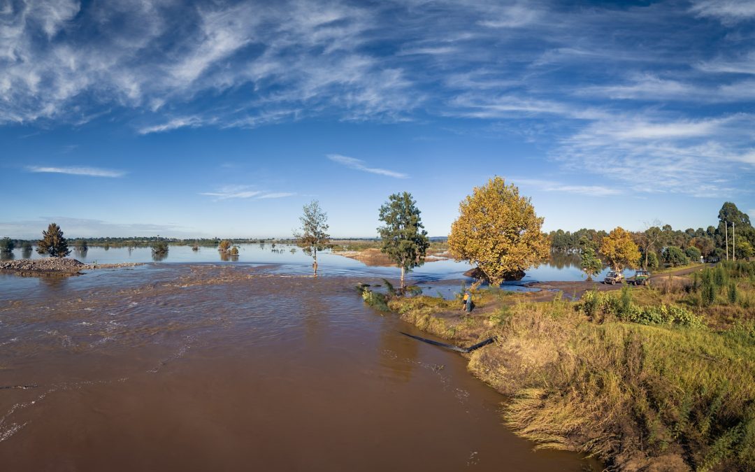
Riverbank subsidence is a big issue along the river system due to the floods
At least now, the clean up is in full swing. We asked Mayor Conolly how it was going and for his thoughts on the emergency.
“I was very proud of the way our organisation responded to the flood emergency,” he said.
“Council staff were working literally 24/7 throughout the emergency, with many staff putting in very significant hours to ensure that people in our community had access to the latest information and were able to access the help they needed.
“Council, of course, is not the lead agency in a natural disaster event, but many of our staff and councillors have valuable local knowledge, and were able to assist the SES and NSW Police with critical information and logistical assistance.
“We have taken over 800 tonnes of flood waste at the Hawkesbury Waste Management facility, in addition to over 1100 skip bins that have been placed throughout the district.
“We have also suffered huge damage to our roads, playgrounds, playing fields and other public facilities.
“Some of the repairs will be funded by the NSW and Federal Governments, but our ratepayers will have to pay for some as well. This will place a strain on Council’s finances into the coming year and may impact what other works we will be able to deliver.
“The amount of work to be done by our Council over the next few months is huge, and in many cases we are still assessing the damage now. We have a highly dedicated but relatively small team that will now be required to do a massive amount of work over the coming months.”
“We will continue to remind our community to use the important resources of our Disaster and Emergency Dashboard and our Flood Recovery webpage.
“It is also important to mention that we also have a wonderful trained Customer Service team who continue to step up to the challenge of supporting our community.
“Our community members can reach out to our Customer Service Centre by calling 4560 4444 and use our online forms 24/7 on Council’s website to report issues and log customer requests,” the Mayor said.
For the price of a coffee…
Many of us like a cup of coffee, and most of us like to know what’s going on in our area. So we’ve got a deal for you – give us the price of a single coffee each month – let’s call it $4.50 – and we’ll keep providing quality daily online news as it happens. You can even read it while you’re having your daily coffee. Support Hawkesbury Post right here.
There are calls for a public health warning to...
The Hawkesbury River surged well over two metres...
From the Editor Here we are again, grappling...
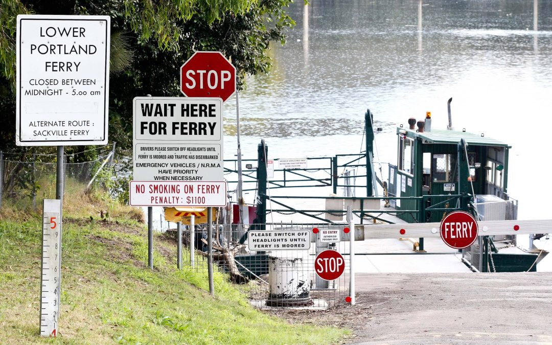
Residents of Lower Portland, commuters and...

168 Francis Street, Richmond Discover the...

55 Arcadian Road Kurrajong, NSW 2758 Nestled...

Hamish Rogers Realty is honoured to be marketing...

259 Cattai Rd Pitt Town Hamish Rogers Realty is...

When Pankaj Bhatia isn't managing his busy...

Equestrian sponsor Bowral Kubota has swung in to...

In the fast-paced world of sailing, where...

In a surprising turn of events, self-proclaimed...
Windsor Optometry recently celebrated a...

In the lead-up to National Bird Week, Hawkesbury...

From 10am on Wednesday, children aged 0-5 years...

The Windsor Function Centre has come alive with...